What is E Surrender
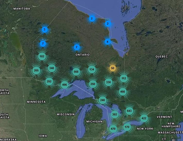
Surrender Sites Reporting Tool

Someone left a pamphlet in my mailbox!
LIFE AFTER AGGREGATES, eSurrender
The rehabilitation of pits and quarries is an important step in the sustainable management of aggregate resources in the Province. Proper rehabilitation helps to transition from a land-use of aggregate extraction to other productive land-use activities, which reduces land-use conflict and addresses social, economic, and environmental concerns. While exceptional rehabilitation practices exist and are often applied, they can go unnoticed and unappreciated by the public due to a lack of transparency.
This was emphasized in the report on the 2013 Review of the Aggregate Resources Act by the Standing Committee on General Government. Developed by TOARC in response, eSurrender is an electronic database of surrendered aggregate licences and permits in the Province of Ontario providing information on the end- use of restored aggregate sites.
One of the main purposes of the Trust is education, training, publishing and dissemination of the information on aggregate management. The Surrendered Sites Reporting and Mapping Tool is bridging communication and informational gaps between the aggregate industry and the public by communicating the end-use/ rehabilitation of pits and quarries across Ontario.
So, what is this tool and why should I check it out?
The tool provides all kinds of information on the end- use of rehabilitated aggregate sites. The online tool contains information on a site-by-site basis detailing the current and surrounding land-uses as well as information on the licence/permit itself, including operation type, licence/permit class, licensed area, location, and surrendered date. A photographic record of the sites is also available!
We encourage you to visit the Surrendered Site Reporting and Mapping tool and explore the surrendered licences and permits in your community! Maybe your favourite park was once a pit used to build the community you live in!
TOARC is continuing to update this database, but there might be gaps in this data as information is retired according to MNR retention schedules and TOARC has done its best to find and combine data from multiple sources. We also want the industry, public and government to recognize that the Aggregate Resources Act (ARA) was enacted in 1990 as amended from the Pits and Quarries Control Act (1971). Consequently, this database covers a large temporal scale where standards, policy, procedures and regulations have changed over time. In addition, the information in this database on current and surrounding land-use is only reflective of the land usage on the date of the TOARC visit. That is, the land-use may have changed since the Surrender date as the management of the land post surrender is not subject to the ARA and becomes a decision of the landowner.
The Surrendered Sites Reporting and Mapping Tool provides a more complete understanding of the end-use of former pits and quarries and has the potential to be used to support licence and permit applications, provide information at public consultation meetings, be utilized for research initiatives and serve as an educational tool for end-use possibilities!

